Things to do
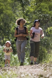
Take a leisurely walk on one of the park's trails.
Photo credit: Adam Creed, Queensland Government
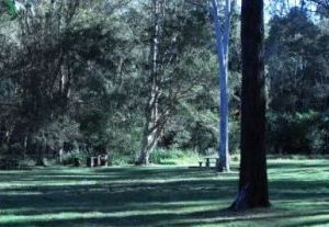
Bunyaville's open grassy areas are a great place for a relaxing picnic.
Photo credit: Queensland Government
- Bunyaville Conservation Park map—shared trails and facilities
- Bunyaville picnic area and walking tracks map
Bunyaville Conservation Park offers many opportunities for the visitors to explore and enjoy the natural surrounds.
Camping and accommodation
Camping
Camping is not permitted in Bunyaville Conservation Park.
Other accommodation
There is a range of holiday accommodation in and around Brisbane. For more information see the tourism information links.
Walking
- Bunyaville Conservation Park map—shared trails and facilities
- Bunyaville picnic area and walking tracks map
Five bushwalking tracks can be accessed from the picnic area. Tracks are classified according to Australian Standards.
| Walking tracks | Classification | Distance | Time | Description |
|---|---|---|---|---|
| Bunyaville track | Grade 3 | 1.6km | Allow 45min | This track leaves from the northern end of the picnic area and leads through open eucalypt forest to the southern end of the day-use area. You may be lucky enough to see a carpet python basking in the sun or a large grass-yellow butterfly Eurema hecabe flutter by. Watch and listen for the pied currawong and laughing kookaburra. |
| Tree discovery circuit | Grade 3 | 1.1km | Allow 30min | The circuit branches off the Bunyaville track. It meanders through dry open forest past a diverse range of eucalypt species. Look out for koalas occasionally seen high in the trees. The circuit can also be accessed from the Classroom and Education Centre tracks. |
| Education Centre track | Grade 3 | 250m one way | Allow 10min | This short track leads past the Bunyaville Environmental Education Centre and down to the Tree discovery circuit. |
| Classroom track | Grade 3 | 270m one way | Allow 10min | This track leads to several amphitheatres in the forest—lovely places to sit and listen to birds or just enjoy nature. |
| Powerful owl track | Grade 3 | 560m one way | Allow 15min | This walk guides you alongside Abany Creek through forest dominated by spotted gum, grey gum and ironbark. Look out for possum, goanna and koala scratches on the smooth bark of the grey gums. |
You can also walk on the shared trails in Bunyaville Conservation Park unless otherwise signed. Watch out for bikes and horses and follow the give-way code for multi-use trails.
Visitors can also enjoy bushwalking with their dogs on the shared trails and designated walking tracks only. Dogs must be on a leash and under control at all times. Each trail entry has a sign indicating which recreational activities are permitted.
Horse and mountain bike riding
Horseriding
Horses may be ridden on all shared recreational trails in Bunyaville Conservation Park unless otherwise signed. Horseriders are not permitted to ride on the designated mountain bike trails or walking tracks. For more information on horseriding trails in South East Queensland visit the SEQ horseriding trail network.
To help reduce your impact on our natural areas please observe the following code of conduct:
- Only allow horses to cross natural watercourses at the designated crossing points on the trail to protect watercourses in the area.
- Minimise damage to vegetation. Do not allow horses to graze on any vegetation while in the area.
- Avoid spreading weeds—ensure horses’ coats, hooves and equipment are free of seeds before visiting the park.
Mountain-bike riding
There are ten designated mountain bike trails in Bunyaville Conservation Park. In addition, mountain bikers are permitted on all the shared trails in Bunyaville Conservation Park, unless otherwise signed.
Horseriders and bushwalkers are not permitted on these designated mountain bike trails.
A high level of fitness and sound navigational skills are required to ride on the designated mountain bike trails. The undulating landscape of the park is perfect for cross-country mountain-bike riding. Challenging gradients, soil types, natural obstacles and vegetation make the rides interesting.
Mountain bike trails (horses and walkers prohibited)
Mountain bike trail distances are one-way.
| Trails | Classification | Distance | Time | Description |
|---|---|---|---|---|
|
Track 1 Wallaby trail | Intermediate | 900m | Allow 5 to 10min | Wallaby trail drops down into Kingfisher Creek and then winds up to the GT break. |
|
Track 2 Jurassic | Difficult | 1.36km | Allow 10 to 20min | Jurassic trail is for experienced riders only. This is a one-way trail that features many challenging obstacles and drop-offs. |
|
Track 3 Gum nuts | Intermediate | 1.32km | Allow 10 to 20min | When starting from the Jinker track, this trail runs mostly downhill to Sandy Creek. |
|
Track 4 Creek trail | Intermediate | 980m | Allow 10 to 15min | Creek trail is a picturesque trail that crosses Albany Creek multiple times. |
|
Track 5 Kokoda | Intermediate | 545m | Allow 5 to 10min | Kokoda follows an upper tributary of Albany Creek between Creek trail and Collins Road break. Watch out for tricky rock causeways. |
|
Track 6 Carnivore | Difficult | 790m | Allow 5 to 10min | The Carnivore trail is very steep. |
|
Track 7 Steps | Intermediate | 820m | Allow 5 to 10min | Steps trail follows a gentle-sloping ridge before dropping quickly through a series of switchbacks to the old dam. |
|
Track 8 Suger glider | Intermediate | 1.5km | Allow 10 to 20min | Sugar glider trail is an undulating trail—great for improving your climbing skills. |
|
Track 9 Mini van | Intermediate | 1.1km | Allow 5 to 10min | Mostly ridden downhill from the Bunya Road end of the trail. This track is a XC flow trail with B lines around some of the technical trail features. Minivan takes its name from the rusty remains of a car that can be seen laying on its roof beside the trail. |
|
Track 10 Zig-zag | Intermediate | 465m | Allow 5 to 10min | Zig-zag trail features many tight corners along a short downhill run. |
Other designated mountain bike and shared trails can also be found close by at Samford Conservation Park. Ride or drive the short distance from Bunyaville Conservation Park to Samford Conservation Pak as shown on the linkages map .
D’Aguilar National Park and sections of Daisy Hill Conservation Park (part of the Koala Bushland Coordinated Conservation Area) also have shared trails and designated mountain bike trails. Mt Coot-tha Forest also has multiple-use trails; a mountain bike trail map is available from the Brisbane City Council website. Many of the trails in these areas have large hill climbs and require a higher level of fitness.
Follow the give-way code
 |
|
Ride safely
- Always wear a helmet.
- Follow the give-way code.
- Plan ahead; ride within your ability and according to track conditions.
- Slow down and consider other track users.
- Avoid riding in large groups.
- Avoid riding on soft, wet and muddy tracks.
- Ride only on formed roads and trails designated for riding. Do not take shortcuts or form new tracks as this damages the environment and causes erosion.
- Respect areas closed to riding.
- Be aware that mobile phone reception can be unreliable in this area.
Guided tours and talks
Bunyaville Environmental Education Centre
Education Queensland operates the Bunyaville Environmental Education Centre in the reserve. The centre provides educational programs for schools. Contact the centre for details and bookings on (07) 3353 4356 or visit the Bunyaville Environmental Education Centre website.
Picnic and day-use areas
Enjoy a picnic in the Bunyaville picnic area. Picnic tables and toilets are provided.
If visiting in a large group, or as part of an organised activity permits are required for commercial or organised events. View permits and fees for further information.
Viewing wildlife
The sights and sounds of lorikeets, kookaburras, parrots, doves and a myriad of other native birds fill the forest at Bunyaville. The park is also home to koalas, echidnas, wallabies and possums.
- There are currently no park alerts for this park.