Basin Hole camping area
Set up camp high above Jam Tin Creek and spend your days fishing, exploring and soaking up the peace and solitude.
Accessible by
- 4WD
Camping area facilities
- Campfires allowed (conditions apply)
- Generators allowed (conditions apply)
- Tent camping
- Camper trailer camping
- Tent camping beside car
- Fishing
-
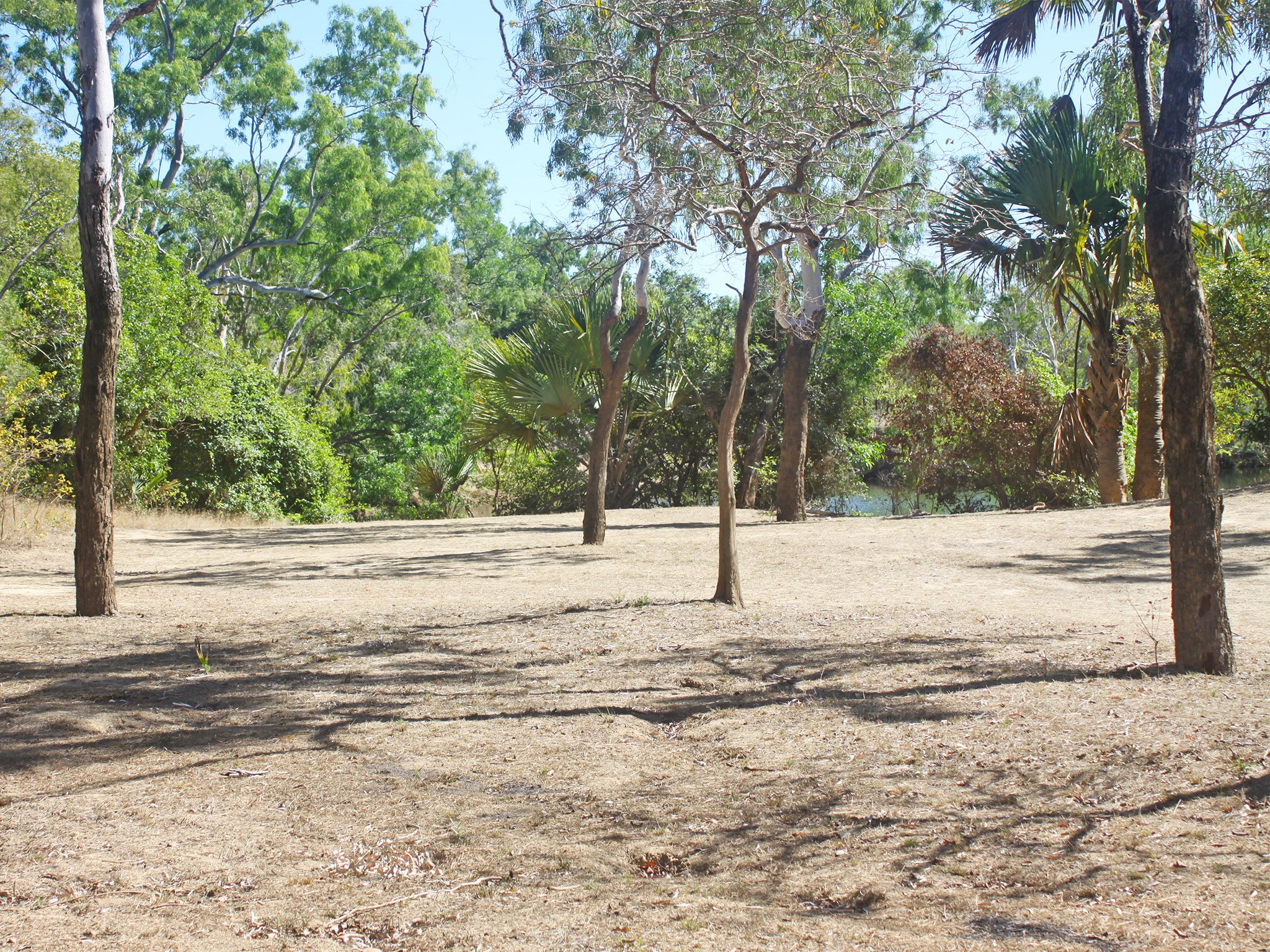
![Spend the night at an old staging post from the cattle droving days.]() Spend the night at an old staging post from the cattle droving days.
Photo credit: Doug Davidson © Queensland Government
Spend the night at an old staging post from the cattle droving days.
Photo credit: Doug Davidson © Queensland Government
-
![Basin Hole camping area is on a high bank above Jam Tin Creek.]() Basin Hole camping area is on a high bank above Jam Tin Creek.
Photo credit: Doug Davidson © Queensland Government
Basin Hole camping area is on a high bank above Jam Tin Creek.
Photo credit: Doug Davidson © Queensland Government

Always check
- Park alerts for the latest information on access, closures and conditions.
- Bureau of Meteorology weather forecasts.
- Current bushfire warnings and incidents and also fire bans and restrictions.
- Your camping permit is booked – book online.
- Any park-specific camping information for Rinyirru (Lakefield) National Park (CYPAL).
- Visiting Rinyirru (Lakefield) National Park (CYPAL) safely for important safety information.
Visitors need to book their camping permit before they visit. Book online, at an over-the-counter booking office or by phone.
This shady camping area has 1 camp site, so you will have the place to yourself. Sit back in a camp chair beside the fire and think back to a time when this was a staging post for teams moving cattle across the countryside.
Flick lures or drop a bait from the bank into Jam Tin Creek—you might just land a barra for dinner. It will taste delicious cooked over the coals of the camp fire.
Spend the day exploring the network of roads that lead to flower-covered lagoons and lakes, endless plains and important historical sites.
Rinyirru (Lakefield) National Park (CYPAL) is jointly managed by the Rinyirru (Lakefield) Aboriginal Corporation and the Queensland Government.
Getting there and getting around
Basin Hole camping area is in the northern part of Rinyirru (Lakefield) National Park (CYPAL), 340km north-west of Cairns, and 140km west of Cooktown, on southern Cape York Peninsula.
- Basin Hole camping area is north of Hann Crossing on Jam Tin Creek.
- You need a 4WD to access the national park (CYPAL) and camping area.
- Read 4WD with care for important information on 4WD safety and minimal impact driving.
From the north
- Take the Lakefield turn-off at the Musgrave Roadhouse on the Peninsula Developmental Road and drive 38km east on Marina Plains Road to the national park (CYPAL).
- Continue 46km through the national park (CYPAL) to Hann Crossing.
- Turn left and drive a further 9km north-east to the camping area.
From the south
- Drive 2km north past Laura on the Peninsula Developmental Road and take the Lakefield turn-off.
- Drive 25km to the park.
- Continue 68km north through the national park (CYPAL), past the Lakefield ranger base, to the camping area.
From Cape Melville
- Drive 70km from Wakooka in Cape Melville National Park (CYPAL) to Kalpowar on the eastern boundary of Rinyirru (Lakefield) National Park (CYPAL).
- Continue 1km through the national park (CYPAL) on Lakefield Road.
- Turn right and drive 28km north to the camping area.
Before you visit
Seasonal closures
Rinyirru (Lakefield) National Park (CYPAL) is closed throughout the wet season every year.
- Camping areas south of Lakefield ranger base are closed from 1 December to 31 May.
- Camping areas north of the Lakefield ranger base are closed from 1 December to 30 June.
- These dates vary each year depending on weather and road conditions.
- Refer to the park map for location of the Lakefield ranger base and camping areas.
Basin Hole camping area
Photo credit: © Queensland Government
Camping area features
The camping area is on the flat above a steep (2m high) bank of the tidal Jam Tin Creek. Historically, this area was used as a staging post when moving cattle. Large crocodiles are frequently seen here—Be Crocwise in Croc Country.
Location: northern part of the national park (CYPAL) on Jam Tin Creek—by road, 28km north of Lakefield ranger base and 9km north-east of Hann Crossing.
Map: Rinyirru (Lakefield) National Park (CYPAL) northern camping areas map
Access: the camping area can be reached by four-wheel-drive vehicle only. It is not accessible for caravans, campervans or buses. The road becomes impassable after rain.
Boat launching: nil.
Number of sites: 1 numbered site—maximum 2 cars and trailers (6 people).
Camp sites are suitable for: tent camping beside your car and camper trailers
Camp site surface: dirt and grass (seasonal).
Shade: partial shade.
Facilities: nil.
Open fires: allowed (except when fire bans apply). Fuel stoves are recommended. Do not collect firewood in the national park (CYPAL).
Generators: only generators operated at less than 65dB(A), when measured 7m from the generator, are permitted, and only between 8am and 7pm.
Essentials to bring: adequate food and drinking water (no fresh water is available), rubbish bags, insect repellent, mosquito nets, fuel stove and adequate fuel and spare parts for your vehicle. Read more about before you visit.
Mobile phone coverage: not available.
Bookings
Advance bookings are essential. Book online or learn about our camping booking options.
Visiting safely
For more safety information see Visiting Rinyirru (Lakefield) National Park (CYPAL) safely and camp with care.
- Viewing platform closed: Red lily lagoon, Rinyirru (Lakefield) National Park (CYPAL) 1 June to 30 November 2026
- Temporary closure for public safety: Kennedy Bend camping area, Rinyirru (Lakefield) National Park (CYPAL) 18 May to 30 November 2026
- Livestock muster, Rinyirru (Lakefield) National Park (CYPAL) 3–30 September 2026