Drives
Driving the quiet gravel roads will give you a different view of the Eungella National Park and Mackay Highlands area.
Some areas are accessible only by high clearance 4WD vehicles. To find out where each drive starts and finishes, match the map references below to the Eungella and Mackay Highlands Discovery Guide (PDF, 2.6MB) .
Please read Four-wheel-driving in parks and the associated Four-wheel drive with care safety information before you drive in Eungella National Park and the Mackay Highlands.
Pine Grove to Broken River
Distance: 5km one way
Time: 10min drive
Map reference: (1)–(3)
Details: This is a winding drive along a sealed road, suitable for 2WD vehicles. Drive through lush rainforest, past Sky Window and through open pasture to Broken River. Fern Flat and Broken River camping areas are accessible to 2WD vehicles. Commercial cabin-style accommodation is available at Broken River Mountain Resort.
Contact Mackay Tourism for details.
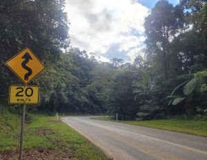
Slow down and enjoy the drive from Pine Grove to Broken River.
Broken River to Crediton Hall
Distance: 9.7km one way
Time: 20min drive
Map reference: (3)–(5)
Details: Drive from rainforest to Crediton's quiet farming communities along unsealed roads accessible to 2WD vehicles. Please watch for walkers along the roads. From Broken River, drive south along the winding Eungella Dam Road for 3km and take a left turn into Crediton Loop Road. Turn right after the Wishing Pool Circuit track entrance and continue along this road 3km to Crediton Hall. This area is suitable for a day-time picnic stop with tables and toilets as part of the vehicle-accessible camping area managed by the Mackay Regional Council; see Crediton Hall campground for more details.
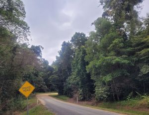
Take care, the Crediton Loop Road has sections of unsealed (gravel) road.
Crediton Hall to Denham Range
Distance: 33.3km one way
Time: 60min drive
Map reference: (5)–(6)
Details: Pass through farming communities to open woodland on steep gravel roads, suitable only for 4WD and high clearance vehicles. Please watch for walkers along the roads. Head south-west along Crediton Loop Road and admire tall stately rose gums more than a century old. Turn left into Eungella Dam Road and travel 4.7km before taking another sharp left into Cockies Creek Road. This road takes you to a series of rough tracks leading to Denham Range camping area.
Denham Range to Moonlight Dam (via Eungella Dam Road and Turrawulla Road)
Distance: about 100km one way
Time: 2hr drive
Map reference: (6)–(7)
Details: Gravel tracks are suitable only for 4WD and high clearance vehicles. Please watch for walkers along the roads. Retrace the rough gravel tracks and Cockies Creek Road, turn left into Eungella Dam Road, follow for 14.8km, then turn left into Lizzie Creek Road and follow this for 17.3km. Turn left into Turrawulla Road and continue 40km to the signed left turn into Moonlight Dam. It is then a further 6km to Moonlight Dam camping area.
The Dray Track is accessible to walkers only (see map). To travel to Moonlight Dam from Denham Range, prepare for a long drive. Alternatively, access Moonlight Dam from Broken River (88km) or Nebo (45km).
Broken River to Moonlight Dam
Distance: about 88km one way
Time: 1hr drive
Map reference: (3)–(7)
Details: If driving direct from Broken River, follow Eungella Dam Road for 24.5km, then turn left into Lizzie Creek Road and follow this for 17.3km. Turn left into Turrawulla Road and continue 40km to the signed left turn into Moonlight Dam. It is then a further 6km to Moonlight Dam. Gravel roads are suitable only for 4WD and high clearance vehicles.
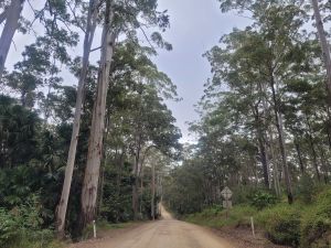
Gravel roads to Moonlight Dam are suitable for 4WD and high clearance vehicles only.
Moonlight Dam to Mount Britton
Distance: 15km one way
Time: 20min drive
Map reference: (7)–(8)
Details: This is a gravel road suitable only for 4WD and high clearance vehicles. Please watch for walkers along the sections. From Moonlight Dam, retrace 6km back to the turnoff and turn left into Turrawulla Road. Follow this road for about 2.5km, turn left into Homevale Road and then drive another 5.5km to reach Mount Britton. All buildings are gone but Isaac Regional Council has marked original streets and presented historical photographs to give you a glimpse of the former gold mining town in the 1880s.
- There are currently no park alerts for this park.