Visiting the Mackay Highlands Great Walk safely
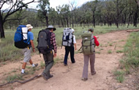
Overnight walkers in the remote Homevale section.
Photo credit: © Queensland Government
Getting there and getting around
The Mackay Highlands Great Walk 56km multi-day hike (3–5 days) starts in Eungella National Park, 80km west of Mackay via the Mackay–Eungella Road.
Hike the multi-day Great Walk from north to south, this will enable you to follow trail markers and avoid the extremely steep climbs in often dry and exposed conditions. The walk begins at Pine Grove in Eungella National Park, passes through Crediton State Forest and finishes at Moonlight Dam in Homevale National Park.
Getting to the Pine Grove trailhead
At the bottom of Eungella valley the Mackay-Eungella Road winds sharply and steeply up to the top of Clarke Range (not recommended for caravans) to the township of Eungella. When you reach the township, follow the road sweeping left to arrive at Pine Grove car park, located at the edge of Eungella township.
Getting to the Moonlight Dam trail exit
The Mackay Highlands Great Walk ends at Moonlight Dam in Homevale National Park (reached via Broken River or Nebo). When arranging to be picked up from Moonlight Dam be aware that some roads are gravel and suitable only for high clearance 4WD vehicles in wet conditions.
- From Broken River: follow Eungella Dam Road for 24.5km and turn left into Pipeline Road (also called Lizzie Creek Road). Follow this road for 17.3km and turn left into Turrawulla Road. From here, it is 36.1km to the signed left turn into Moonlight Dam. The camping area is 6km from this turn-off.
- From Nebo: drive towards Mackay along the Peak Downs Highway for 6km and turn left into Nebo-Glenden Road (also called the Suttor Developmental Road). Follow this road for 11.2km and turn right into Turrawulla Road. From here, drive about 23km past the Homevale–Mount Britton turnoff to the signed right turn into Moonlight Dam. The camping area is 6km from this turn-off.
For road information contact Queensland Transport and the Bureau of Meteorology for weather reports and forecasts. Remember to check Park alerts for the latest information on Parks and forests access, closures and conditions.
Staying safe
Expect the best but prepare for the unexpected! Taking on the entire 56km multi-day Great Walk is only recommended for experienced hikers with a high level of fitness. Sections of the Great Walk are remote, and you must be responsible for your own safety. Accidents can happen even to the most experienced hiker. Nature can be unpredictable with storms, fires and floods occurring without warning. You must always be aware of your surroundings, stay alert and exercise sound judgment.
For a quick overview of Mackay Highlands Great Walk, see the Mackay Highlands Great Walk locality map. Refer to the walking page for track grades and details for each section of the Great Walk, including sourcing topographical maps.
Follow these guidelines to ensure a safe and enjoyable hike
- Before leaving home, check Park alerts for the latest information on Parks and forests access, closures and conditions.
- Check weather forecasts a few days before starting your walk by visiting the Bureau of Meteorology. Never undertake the Great Walk if severe weather is predicted.
- Pre-arrange your vehicle support, pickup location and time. Do not rely on mobile phone coverage from camping areas on the day, coverage is limited.
- Never walk alone—small groups of about four are ideal.
- Avoid walking in extreme heat or during periods of high fire danger.
- Watch your head! High winds can cause branches to fall. In extreme winds, camping is not advisable, walkers’ camps may be closed temporarily.
- Always be observant for changes in the weather.
- Carry enough drinking water, four to six litres a day, food, emergency communication equipment and a comprehensive first-aid kit.
- Wear sturdy enclosed hiking boots or shoes. Tracks can become slippery when wet.
- Heed all safety and warning advice. Obey all closure signs.
- Mobile phone coverage is limited, and help can be many hours away. It is recommended that hikers carry a satellite phone and a Personal Locator Beacon (PLB).
- Ensure you leave a walking and emergency plan with a responsible person who will contact emergency services if you do not return within an agreed time.
Read the Visiting safely information in Eungella, Credition and Homevale for further details on staying safe in the Mackay Highlands. And follow the Parks and forests stay safe and visit with care guidelines.
When to visit
The best time of year to hike the multi-day Mackay Highlands Great Walk is between April and September, to avoid hot steamy conditions and stormy weather. The walk may be closed during periods of high fire danger, severe weather or park management activities. Remember, check Park alerts for Eungella, Crediton and Homevale before leaving home.
Walk safely
- Know your location at all times, keep to the marked track and know your exit points. Take copies of the relevant topographic maps, navigation equipment, a compass and whistle with you. Mark your progress on the map against features on the track.
- Keep your group together. Know your group’s hiking abilities, experience and skills. Adjust your hiking plan as necessary.
- If difficult weather sets in or someone becomes ill, make camp and wait for weather conditions to improve or for help to arrive.
- Plan to reach your camp well before dark. Do not walk at night.
- Carry at least one form of communication equipment. Satellite phones and Personal Locator Beacon (PLBs) are the most effective in this area. Mobile phone coverage is unreliable.
- Always carry enough water for one day and evening. Refill containers from water tanks at camping areas. Treat all water from creeks and tanks before drinking.
- Wear a long sleeve shirt and pants and use insect repellent regularly to help keep insects that bite and sting away.
- Take care on slippery rocks and at creek crossings. Watch you step near cliff edges they can be unstable due to natural weathering—do not climb on rock faces.
Follow the Parks and forests walk with care guidelines.
Fire safety
Bushfires can occur without warning. Be aware of and prepared for any dangers. If there is a bushfire, do not walk towards it. Leave the area, even if it means walking back the way that you have come. Avoid areas of heavy fuel, such as long grass and deep leaf litter, and stay low to the ground where the air is coolest and contains the least smoke.
Never start a walk if you can see smoke or a fire in the park. For the latest information on bushfire warnings and incidents in the area contact Queensland Fire Department (QFD). Rangers carry out planned burning activities as part of park management operations, check Park alerts for updates on scheduled burning before you go. The Great Walk may be closed for your personal safety.
Wildlife safety
You may encounter wild pigs, wild dogs, scrub cattle, dingoes and snakes. Do not approach these animals or excite them in any way—detour around them.
Wear a long sleeve shirt, long pants and insect repellent to protect yourself from insects that bite and sting. And to avoid skin contact with stinging plants.
Regularly check yourself for ticks and leeches throughout the day and before you go to sleep. Remove them immediately, follow Queensland Health advice.
For more information on staying safe in Parks and forests see the be wildlife aware and stay safe and visit with care guidelines.
In an emergency
Phone Triple Zero (000) for critical, serious or life-threatening situations.
Remember, carry at least one form of reliable communication equipment. Satellite phones and Personal Locator Beacons (PLBs) are the most effective in this area. Mobile phone coverage is unreliable with only occasional coverage from the ridgelines.
Consider visiting the Triple Zero website before leaving home. You can download the Triple Zero emergency app, it has GPS functionality that can help identify your location to emergency services. Important: if there is no mobile coverage on any network, you will not be able to reach the Emergency Call Service via a mobile phone.
Before you visit
Careful and detailed planning can make the difference between a safe, memorable adventure or a miserable and dangerous experience. Plan your walk well.
Important steps
- Plan when you will go; how you will be dropped off and picked up; what gear you need to bring and what you will do in an emergency.
- Book your campsites online. To secure a camp site, hikers must book their camping permits before they visit the Mackay Highlands Great Walk.
- Download or print relevant topographic maps.
- Check weather forecasts on the Bureau of Meteorology. Do not attempt the Great Walk if severe weather is predicted.
- Check Queensland Traffic for the latest road conditions.
- Check Queensland Fire Department for the latest information on bushfire warnings and incidents in the area.
- Check Park alerts for Eungella and Homevale national parks, and Crediton State Forest for current information on access, conditions and closures.
Allow 3 to 5 full days to complete the entire 56km Mackay Highlands Great Walk.
Walking plan
Give a copy of your walking plan to a responsible person and make sure they know your exact route, and when you expect to return. If you change your plans, tell them. Have an emergency plan in place if you fail to contact them by an agreed time. If you are overdue or potentially lost, your nominated contact should report this to the Queensland Police Service by phoning Triple Zero (000). The police will organise rescue procedures.
Opening hours
The Mackay Highlands Great Walk is open all year round. Sections may be closed during periods of severe weather, fire danger or for park management operations. Remember, check the latest Park alerts for Eungella, Crediton and Homevale before leaving home for current information on access, conditions and closures.
Essentials to bring
Walkers must be fully self-sufficient. Pack for safety and comfort, but remember you will be carrying everything, so the key is to pack light. Be sure to include the following:
- comfortable, high-quality, ankle-supporting footwear with flexible soles and good grip
- hat, sunscreen and insect repellent
- warm clothes and raincoat—pack for all seasons
- drinking water in re-fillable water containers, plus water purification tablets/kit and filter. Water supplies and water quality cannot be guaranteed. Treat and filter water from all sources before drinking.
- nourishing lightweight food and high-energy snacks. Take extra food in case the walk takes longer than expected. Take sealable containers for leftover and fresh foods
- first-aid kit—know how to use it
- compass, navigation equipment and topographic maps. See Walking for QTopo topographic map details
- sleeping gear (strong, lightweight tent, lightweight sleeping bag and mat)
- rubbish bags (take out what you take in)
- waterproof bags to keep clothing and bedding dry
- torch and batteries, pocket knife and extra batteries for all devices
- lightweight cooking and eating utensils and washing-up equipment
- fuel stove and fuel, lighter or waterproof matches—open fires are only permitted at Fern Flat and Denham Range walkers’ camps (conditions apply)
- toilet paper and a small hand trowel or spade; or human waste disposal kit (e.g. Poo Pot)
- mobile phone (coverage is limited to ridgelines) or satellite phone, and a Personal Locator Beacon (PLB).
Permits and fees
Camping permits are required and fees apply to camp at walkers’ camps along the Mackay Highlands Great Walk. A camping tag with your booking number must be displayed at your camp site.
Important note: To secure a camp site, hikers must book their camping permits before they visit the Mackay Highlands Great Walk.
- Book your Parks and forest camp site online.
- If you cannot book online, see camping bookings for other options.
Crediton Hall campground is managed by the Mackay Regional Council, follow the link for details on how to make a camping booking.
Other permits and fees
Various activities in Queensland parks and forests require a permit. Activities include commercial tours, social events (for example weddings or birthday parties), organised group visits, school excursions, scientific research, professional photography and the sale of photographs or vision of the park. Contact us for further information on permits and fees.
Climate and weather
Walking is recommended between April and September to avoid hot steamy conditions and stormy weather. Be prepared for track closures in times of high fire danger.
The region's dry season generally occurs during the cool month (June to August), with average temperatures from 10°C to 20°C. Check weather forecasts on the Bureau of Meteorology. Do not attempt the Great Walk if severe weather conditions are predicted.
Fuel and supplies
Fuel and supplies are available at Mackay, Proserpine, Finch Hatton and Nebo. For more information see the tourism information links.
- There are currently no park alerts for this park.