The Junction
Enjoy an easy ramble along a creek dotted with rock pools, where springtime wildflowers and a spectacular range of birdlife abound.
- Journey type
- Walk
- Distance
- 5.2km return Start and finish points are the same and the traveller must return via the same path
- Time suggested
- Allow 2hr walking time.
- Grade
- Grade 3 walking track
Accessible by
- Conventional vehicle
Journey facilities
- Walking
-
![Watch water swirl between granite slabs on The Junction walk.]() Watch water swirl between granite slabs on The Junction walk.
Photo credit: © Ted Colles
Watch water swirl between granite slabs on The Junction walk.
Photo credit: © Ted Colles
-
![Pause along The Junction walk to have a splash in Bald Rock Creek.]() Pause along The Junction walk to have a splash in Bald Rock Creek.
Photo credit: Maxime Coquard © Queensland Government
Pause along The Junction walk to have a splash in Bald Rock Creek.
Photo credit: Maxime Coquard © Queensland Government
-
![Enjoy an easy walk along Bald Rock Creek on The Junction walk.]() Enjoy an easy walk along Bald Rock Creek on The Junction walk.
Photo credit: Maxime Coquard © Queensland Government
Enjoy an easy walk along Bald Rock Creek on The Junction walk.
Photo credit: Maxime Coquard © Queensland Government

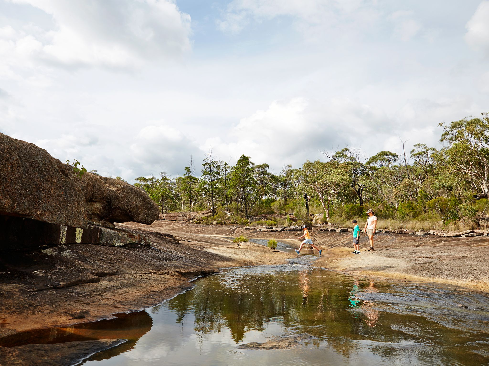
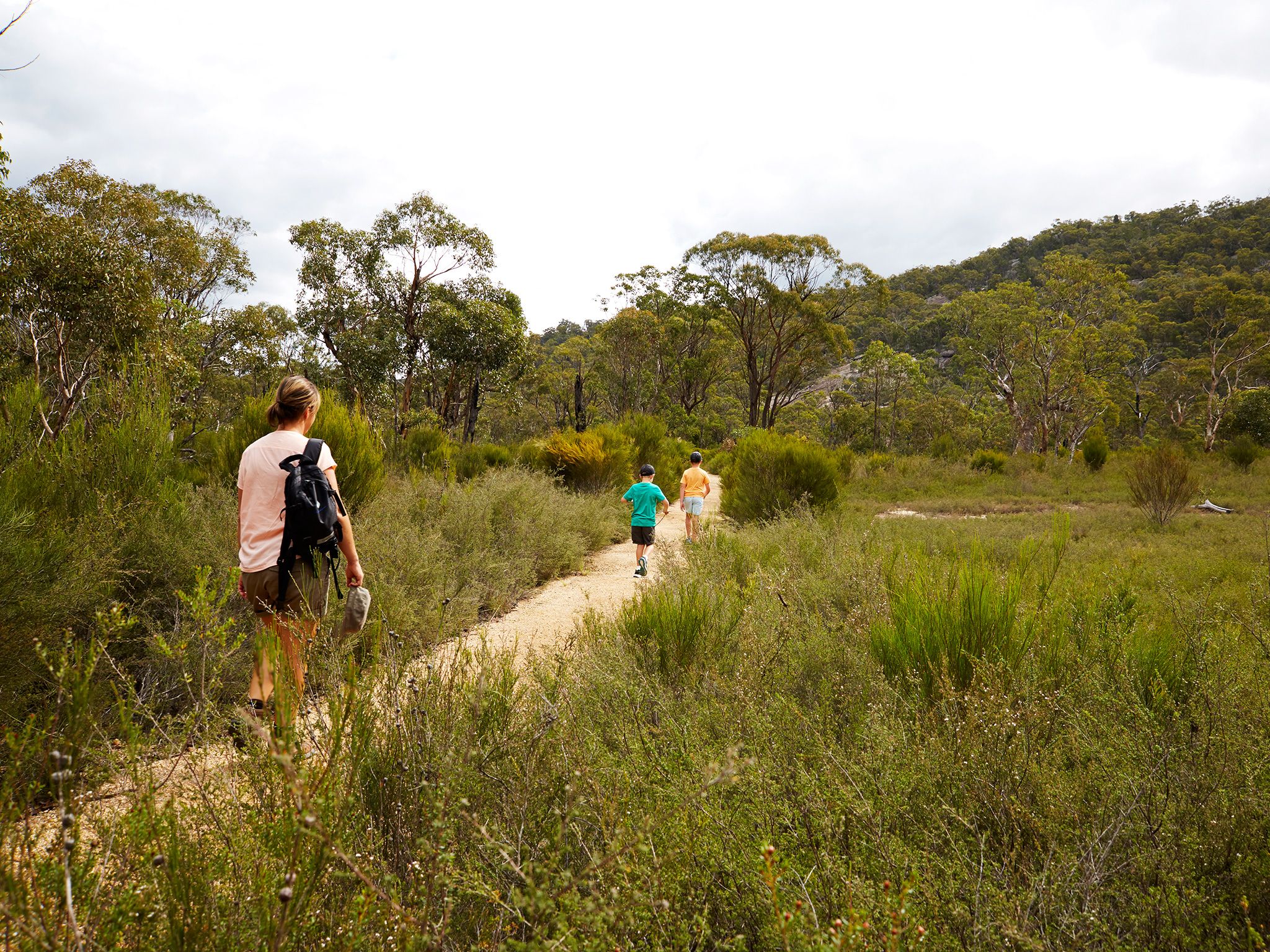
Explore along the banks of Bald Rock Creek, with its cool, dark waters fringed by flowering shrubs that attract honeyeaters and parrots. Rest and dip your toes into a rock pool while you spot superb fairy-wrens, red-browed firetails and thornbills searching the creek-bank thickets for insects.
Cool off with a refreshing dip at one of the many rock holes located near The Junction. During the dry season the creeks may not run, but the landscape and vibrant wildlife still make the walk worthwhile. In spring, the trail is scattered with spectacular displays of colourful wildflowers.
Getting there and getting around
The Junction track is one of the northern walks in Girraween National Park, located on the Queensland–New South Wales border, 260km by road (approximately 3.5hrs) south-west of Brisbane. Helpful hint: screen shot the directions in the event mobile reception is lost.
The Junction track begins at the Bald Rock Creek day-use area. You can also start and end your walk at the Bald Rock Creek camping area.
There are two access roads (northern and western) to The Junction, both accessible by conventional vehicles.
From Stanthorpe to western entrance (approx. 30–45min)
- Continue 26km along the New England Highway to Wyberba (30km north of Tenterfield).
- Turn onto Pyramids Road and follow this winding bitumen road through the Wyberba Valley 6km east to the western park entrance.
- Drive about 3km to the Bald Rock Creek day-use area.
From Stanthorpe to northern entrance (approx. 40–50min)
- Turn onto Sugarloaf Road, which turns into Eukey Road and drive about 15km via Storm King Dam towards Eukey.
- About 1km before Eukey, turn onto Breens Road, drive 2.5km then turn onto Pyramids Road and drive about 6km to the northern park entrance.
- Drive about 4km to the Bald Rock Creek day-use area.
From Tenterfield (NSW) to western entrance (approx. 30–45min)
- Drive 18km north on the New England Highway to Wallangarra.
- In Wallangarra, head north-west and continue on the New England Highway, then turn onto Pyramids Road and drive to the Bald Rock Creek day-use area.
Wheelchair access
There are no wheelchair-accessible facilities.
Before you visit
Opening hours
The Junction is open 24 hours a day.
Check park alerts for the latest information on access, closures and conditions.
Visiting safely
For more safety information see Visiting Girraween safely and Walk with care.
- There are currently no park alerts for this park.