Visiting Wallaman Falls safely
Getting there and getting around
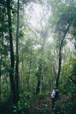
Discover the rainforest at Wallaman Falls.
Photo credit: Steven Nowakowski © Queensland Government
Wallaman Falls is located 51km south-west of Ingham, about 1hr drive through rural landscapes. Travel west from Ingham along Abergowrie Road to Trebonne. From here, the route is well signposted. The road to Wallaman Falls is a sealed bitumen road, suitable for conventional vehicles. Care is required on the range, which is slippery when wet. While the range is steep and winding in sections, a caravan may be towed to the camping area provided that care is taken to drive to prevailing conditions.
The range is steep and winding in sections, but generally small caravans, small motor homes or small buses, can access the lookout, day-use and camping areas, provided that care is taken to drive to prevailing conditions. Hinchinbrook Shire Council have installed a sign indicating the access road to Baŋgurru camping area is unsuitable for trucks, buses, caravans and trailers, please contact the council for further information about road access.
Parking for day-use visitors at the lookout includes small bus parking and spaces for vehicles towing small caravans or trailers. Availability of these spaces varies, depending on peak visitation times and periods and is not always guaranteed.
For your safety access to the top of Wallaman Falls and surrounding escarpment is restricted .
Wheelchair accessibility
Wheelchair access (with assistance) is possible to the Wallaman Falls lookout and toilet, located at the Wallaman Falls lookout day-use area. Camp site 1 at Baŋgurru camping area, is an accessible (with assistance) camp site for people with disability (PWD) displaying a government issued disability parking permit.
Staying safe
- Take care around cliffs, steep slopes and rock faces along the track, and at lookouts.
- Never jump or dive into water – the water may be shallow or there may be submerged objects.
- Do not enter water during and after heavy rain. Rapid creek level rises, fast flowing water and dangerous currents can occur.
- The top of Wallaman Falls and the surrounding escarpment is a restricted access area and entry is prohibited. Natural hazards, including sheet cliffs and an unstable rock face, make this area unsafe, and serious injuries and deaths have occurred.
- In an emergency, call Triple Zero (000). Download the Triple Zero emergency app – it could save your life.
- A free public phone is located at the Baŋgurru camping area.
- Treat all water before drinking.
- Glass is not allowed in or around Stony Creek.
Walk safely
- Carry at least one form of communication equipment. Satellite phones and Personal Location Beacons (PLBs) are the most effective in this area. There is no mobile phone coverage.
- Stay on the tracks and take care on uneven surfaces, especially in wet conditions.
- Wear sturdy, reliable, worn-in footwear.
- Avoid stinging trees. These plants are found at rainforest edges. They grow to 4m high and have large, heart-shaped leaves with serrated edges. Do not touch these plants as it will almost certainly result in a very painful sting. If you are stung, and symptoms are severe, seek medical attention.
- Plan to complete your walk well before dark. Never walk alone.
- Carry adequate drinking water.
- Protect yourself from the sun. Wear sunscreen, a hat and a long-sleeved shirt, even on cloudy days.
- Wear insect repellent, clothing and shoes to protect yourself from stings, scratches and bites.
- Be wildlife aware.
- Detour around snakes, never provoke them.
- Be Cass-o-warry – cassowaries are occasionally seen in Girringun National Park and are potentially dangerous. Avoid unnecessary risk and help protect cassowaries.
- Never approach cassowaries.
- Never feed cassowaries – it is illegal and dangerous and has caused cassowary deaths.
- Always slow down when driving in cassowary territory.
For more information, please read the guidelines on safety in parks and forests.
Before you visit
Essentials to bring
To ensure an enjoyable visit please remember to bring:
- a basic first-aid kit including a space blanket
- adequate clothing for all weather conditions including rain and insects
- a hat, sunscreen, sunglasses and insect repellent
- adequate drinking water – treat all water from day-use and camping areas before drinking
- rubbish bags.
Opening hours
Girringun National Park is open 24 hours a day. Plan to walk in daylight hours only – it can be dangerous to walk in the rainforest in the dark. Some walks may be closed during the wetter months (November to May). Additional closures may occur for management purposes.
Check Park alerts for the latest information on access, closures and conditions.
Permits and fees
Camping permits are required and fees apply. Camping permit details must be clearly displayed at your camp site.
- Book your camp site online.
- If you cannot book online, see camping bookings for other options.
Permits are required for commercial or organised group activities. View permits and fees for further information.
Pets
Please leave your pets at home – domestic animals are not permitted in Girringun National Park.
Climate and weather
To ensure your experience is fun and comfortable, try to visit between April and September when the weather and track conditions are at their best.
Daytime temperatures and humidity can be high at any time of the year and nights can be very cool. Frosts can occur in some elevated areas. Please carry suitable clothing to accommodate all extremes. July to October is generally the driest period, but heavy rain can fall at any time.
Check the Bureau of Meteorology for the latest weather reports.
Fuel and supplies
Fuel and supplies are available from local towns such as Ingham, Cardwell and Townsville.
- Public phone out of order: Baŋgurru camping area, Wallaman Falls, Girringun National Park 31 October to 28 November 2026
- Temporary walking track closure: Djinda walk, Wallaman Falls, Girringun National Park 9–20 November 2026
- Temporary camping areas and walking track closures: Wallaman Falls and section of Wet Tropics Great Walk, Girringun National Park 8 April to 30 October 2026
- Planned burn season: Oak Hills, Girringun National Park 3 June to 30 October 2026
- Planned burn season: Wet Tropics Great Walk between Stony Creek walkers’ camp and Henrietta Gate pick up point, Girringun National Park 3 June to 31 October 2026
- Planned burn season: mountain range south of Wallaman Falls Road, Girringun National Park 15 June to 31 October 2026