Nature, culture and history
We recognise the Ghungalu people, the traditional custodians of Blackdown Tableland National Park, and pay our respects to Elders past and present.
Sculpted sandstone
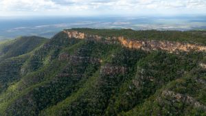
The flat-topped plateau of Blackdown Tableland National Park
Photo credit: © Queensland Government
The Dawson, Expedition and Shotover ranges rise high above the surrounding plains and converge at Blackdown. The reddish-brown, coarse-grained quartz sandstone belongs to the Clematis Group. This sandstone is ancient, originating around 240 million years ago when fast-flowing rivers washed vast, thick layers of sand into the great depression of the Bowen Basin.
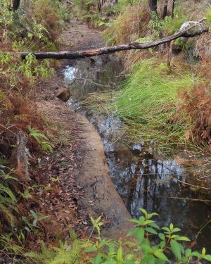
Springs are vital for wildlife during dry times.
Photo credit: Queensland Government
Over time, the weight of overlying sediments and compressive forces from the east hardened these sands into the grainy rock known as sandstone. As the older, softer sediments eroded away, the more resistant sandstone remained as a flat-topped tableland flanked by sheer escarpments and deep gorges.
The escarpments line the northern and western edges of the national park. To the east, a deeply cut gorge system forms drainage lines that contribute to the Fitzroy Basin, offering important protection to these catchments. The highest point on the tableland rises to about 900m above sea level, with an average elevation of around 800m. Annual rainfall exceeds 1,000mm. Sitting on the eastern margin of the Great Artesian Basin, the sandstone plateau acts as an intake zone, where rainfall infiltrates to replenish the basin. Local springs and creeks support wildlife year-round.
Elevation and isolation
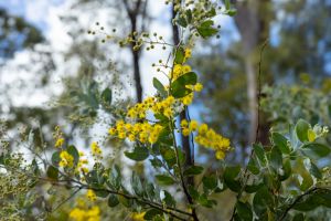
One of the species of wattle found at Blackdown Tableland National Park
Photo credit: Queensland Government
Blackdown Tableland supports heathlands, dry eucalypt forests and moist pockets of ferns, mosses and orchids. Its elevation creates a cooler, moister microclimate than surrounding plains. This isolation supports endemic species such as the Rainbow Falls callistemon, Blackdown stringybark and two species of wattle.
Hard to find but fascinating, Blackdown Tableland’s unique insects include the Blackdown ‘monster’, a cricket‑like species that lives underground and surfaces only after rain! On warm summer evenings, you may also encounter the rare Christmas beetle Anoplognathus blackdownensis. This small beetle—the female has a metallic green head—is endemic to Blackdown Tableland.
Abundance of wildlife
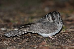
The Australian Owlet-nightjar is the smallest of the nocturnal birds.
Photo credit: John Augusteyn © Queensland Government
The tall open forests with a mid-height understory host a rich variety of wildlife. By night, gliders, bats and owls emerge. By day, kingfishers, kookaburras, currawongs, cockatoos, robins and tree-creepers are common. Peregrine falcons and goshawks hunt along cliffs. Skinks, goannas, frogs, butterflies and dragonflies thrive across the national park.
Connections over time
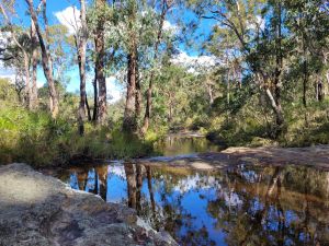
The tranquil waters of Mimosa Creek after the ‘wet season’ rain.
Photo credit: © Linda Thompson
Blackdown Tableland National Park is of great significance to the Ghungalu people who have a deep-rooted responsibility to look after their cultural sites and Country. Rock art sites are a visual reminder of their long connection to this landscape. Visitors can learn the meanings behind Ghungalu names such as Mook Mook and Munall and imagine Moonda Gudda—‘water of life’— flowing across the landscape.
European history includes William Yaldwin, who gave the English name to the tableland in 1869 after his family home in Sussex—Blackdown House. His attempts to graze cattle on the tableland failed due to phosphorus-deficient soils, which caused the cattle to develop chalky bones. Bordering the northern boundary of the national park, the Old Coach Road once linked Rockhampton to Springsure, transporting wool on wagons until rail connections reached Blackwater in 1877. Sections of the stone-pitched road can still be found today.
Between the 1970s and 1980s, the area was a State forest. In 1982, Blackdown Tableland was gazetted as a national park for its conservation, recreation and scenic values. Queensland Parks and Wildlife Service manages the national park with the Ghungalu people to protect its natural and cultural heritage.
- Closure 4WD Loop Road 30 July to 1 November 2026