Harrys day-use area
Savour the peace and quiet of this sheltered picnic area with a fascinating history on the banks of the Upper Noosa River.
Accessible by
- High clearance 4WD
- Boat
- Canoe or kayak
Attraction facilities
- Picnic tables (some sheltered)
- Toilets (non-flush)
- Wheelchair access (may require assistance)
-
![Take a break from paddling and enjoy a picnic at Harrys day-use area.]() Take a break from paddling and enjoy a picnic at Harrys day-use area.
Photo credit: © Chris Whitelaw
Take a break from paddling and enjoy a picnic at Harrys day-use area.
Photo credit: © Chris Whitelaw
-
![Go for a paddle, throw in a fishing line or just sit back and take in the views of the Upper Noosa River at this popular day-use area.]() Go for a paddle, throw in a fishing line or just sit back and take in the views of the Upper Noosa River at this popular day-use area.
Photo credit: © Chris Whitelaw
Go for a paddle, throw in a fishing line or just sit back and take in the views of the Upper Noosa River at this popular day-use area.
Photo credit: © Chris Whitelaw
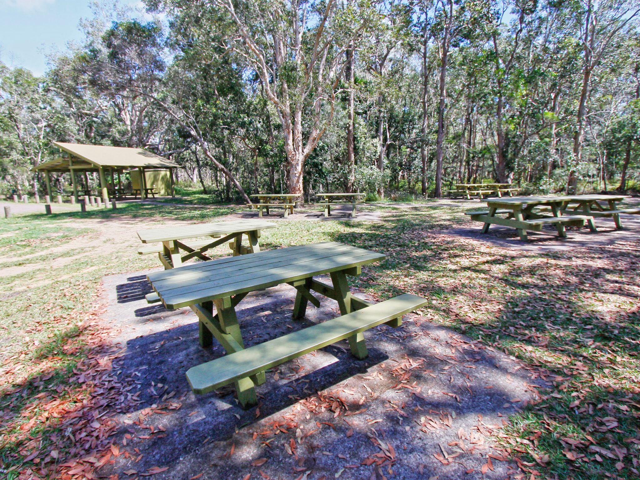

Relax on the riverbank among fringing forests and woodlands of paperbark and eucalypts, after a long day’s walk on the Cooloola Wilderness Trail, a hard day’s 4WD adventuring on Harrys Hut Road or even a tiring day’s paddling on the Upper Noosa River waterway.
Take time to explore the nearby historic Harry's Hut, a timber-getter's hut from the mid-1900s, which was part of the winch-and-crane operation that once transported logs across the Noosa River. Enjoy a spot of river fishing or a shady picnic before you continue your journey, or stay the night in the nearby Harrys camping area.
Getting there and getting around
Harrys day-use area is in Cooloola Recreation Area, Great Sandy National Park, on the Sunshine Coast between Noosa Heads and Rainbow Beach (155–240km north of Brisbane).
- The day-use area is in the southern part of Cooloola, 7km north of the Kinaba Information Centre in the Upper Noosa River waterway.
- Four-wheel drivers can access the day-use area and adjacent Harrys camping area via Cooloola Way and Harrys Hut Road.
- Canoeists and boaties can access the day-use area via Kinaba from Boreen Point and Elanda Point on Lake Cootharaba.
- Tour boats operate daily from Noosa and Tewantin. Canoes, kayaks and small boats can be hired from private operators at Boreen Point and Elanda Point.
- For tourism information for all regions in Queensland, see Queensland.com, and for friendly advice on how to get there, where to stay and what to do, find your closest accredited visitor information centre.
- Walkers can also access the camping area on the Cooloola Wilderness Trail.
Via Harrys Hut Road
- From Brisbane, drive 135km north on the Bruce Highway or the Sunshine Motorway to Tewantin. Follow McKinnon Drive, Louis Bazzo Drive and Junction Road for about 18km north-west to Cootharaba Road. Turn right and travel about 10km along Cootharaba, Kimmond Creek and Dr Pages roads to the Gympie Kin Kin Road. Turn right and drive 6km, then turn right onto Cooloola Way.
- From Gympie, drive 10km east on Tin Can Bay Road, turn right onto to the Gympie Kin Kin Road and drive about 31km, then turn left onto Cooloola Way.
- Drive 4km then turn right onto Harrys Hut Road and drive 10km on this very rough sand track to the day-use area.
- Vehicle access permits are not required for Harrys Hut Road or Cooloola Way but may be required if traversing beaches and other inland tracks within the Cooloola Recreation Area.
- Read 4WD with care for important information on 4WD safety and minimal impact driving.
Via Kinaba
- Read walk with care for tips on walking safely and walking lightly.
By canoe
- Launch your canoe at Elanda Point and paddle 4.5km (1hr) to the Kinaba Information Centre.
- Stay close to the shore line while paddling northwards. Plan to cross Lake Cootharaba early in the morning when conditions are likely to be calm and travel is easiest.
- From Kinaba, paddle a further 1hr 20min to Harrys day-use area.
By boat
- Launch your boat from the Boreen Point boat ramp and follow the lake navigational markers out into deeper water and then head on a north-east trajectory towards the visible Cooloola Sand Patch in the distant landscape.
- When you approach a red navigational marker in the middle of the lake (opposite Elanda Point), turn on a near northerly trajectory to the channel markers through very shallow shoals to the Kinaba Information Centre. The trip is 7km and 15min travel time.
- From Kinaba allow another 45min at 6 knots (and no wash) to travel to Harrys day-use area.
Read water safety for important information about staying safe in and near water and caring for parks.
Via the Cooloola Wilderness Trail
- The Cooloola Wilderness Trail currently has no pedestrian access across Kin Kin Creek due to the pedestrian bridge linking Elanda Point to Fig Tree Point being washed away in flood waters.
- Designs are currently in development to replace the bridge and restore access.
- An alternative temporary start/finish location for the Cooloola Wilderness Trail is the Boronia walk on Harrys Hut Road.
- Limited parking is available at the trailhead of the Boronia walk on Harrys Hut Road.
- From Brisbane, drive 135km north on the Bruce Highway or the Sunshine Motorway to Tewantin. Follow McKinnon Drive, Louis Bazzo Drive and Junction Road for about 18km north-west to Cootharaba Road. Turn right and travel about 10km along Cootharaba, Kimmond Creek and Dr Pages roads to the Gympie Kin Kin Road. Turn right and drive 6km, then turn right onto Cooloola Way.
- From Gympie, drive 10km east on Tin Can Bay Road, turn right onto to the Gympie Kin Kin Road and drive about 31km, then turn left onto Cooloola Way.
- Drive 4km on Cooloola Way then turn right onto Harrys Hut Road and drive 4.5km to the start of the Boronia walk.
- Harrys day-use area is 13.6km along the trail.
- Read walk with care for tips on walking safely and walking lightly.
Wheelchair access
Wheelchair-accessible toilet facilities are provided. Assistance may be required.
Before you visit
Opening hours
Harrys day-use area is open 24 hours a day
Check Park Alerts for the latest information on access, closures and conditions.
Visiting safely
For more safety information see Visiting Cooloola Recreation Area safely.
- Pest Control Program in Cooloola Recreation Area 31 October to 28 November 2026
- Water across Cooloola Wilderness Trail 8 September to 8 November 2026
- Permanent fire prohibition on Teewah Beach 1 April 2021 to 3 July 2027
- Natural Sand Movement and access to Double Island Point 5 December 2025 to 5 December 2026
- Upper Noosa River – Campsite 3 – partial jetty closure 24 April to 24 October 2026
- Exposed sand cliff and dune landslide danger 28 March 2025 to 25 March 2027
- Partial Park closure – Cooloola Wilderness Trail: no pedestrian access across Kin Kin Creek 14 January 2026 to 14 January 2027
Conditions report
Cooloola conditions report Updated 1 Sep 2026
Critical information for your safety is included in the conditions report—always check it before you visit.