Campsite 3 walk
Immerse yourself in this beautiful landscape as you spend a day exploring along the eastern bank of the Upper Noosa River.
- Journey type
- Walk
- Distance
- 7km one way A path where the start point is different to the finish point
- Time suggested
- Allow 3hr walking time.
- Grade
- Grade 4 walking track
Accessible by
- High clearance 4WD
- Boat
- Canoe or kayak
Journey facilities
- Toilets (non-flush)
- Walking
-
![Meander through woodlands of paperbarks, scribbly gums and pink bloodwood trees along this walk.]() Meander through woodlands of paperbarks, scribbly gums and pink bloodwood trees along this walk.
Photo credit: © Steven Nowakowski
Meander through woodlands of paperbarks, scribbly gums and pink bloodwood trees along this walk.
Photo credit: © Steven Nowakowski
-
![Discover fields of spiky grass trees along this river-side walk.]() Discover fields of spiky grass trees along this river-side walk.
Photo credit: © Queensland Government
Discover fields of spiky grass trees along this river-side walk.
Photo credit: © Queensland Government
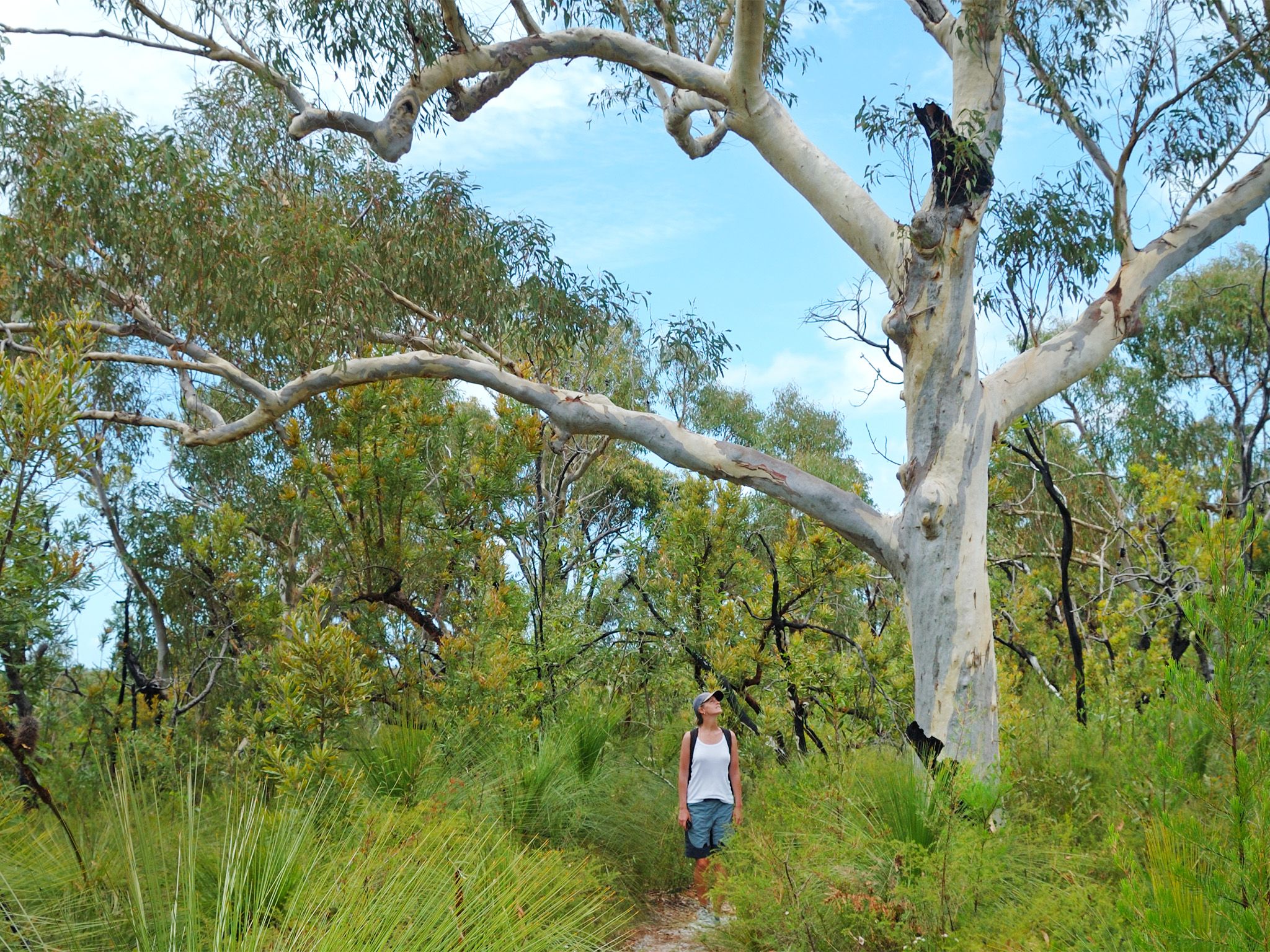

Paddle across the river from Harrys day-use area then spend an enjoyable day meandering along the eastern river bank to Upper Noosa River campsite 3. Discover woodlands and open forests of scribbly gums, pink bloodwoods, paperbark trees and wallum banksias fringing the riverbank along the way.
Your walk will take you past Upper Noosa River campsite 1 (3.1km) and Upper Noosa River campsite 2 (a further 1.9km), before arriving at Upper Noosa River campsite 3 after another 2km. If the camping areas are empty, relax with a meal break on the jetties and landings overlooking the river. Retrace your steps to Harrys day-use area, or stay at Upper Noosa River campsite 3 to start the Cooloola Sand Patch walk the next day.
Refer to the Cooloola and Inskip recreation areas discovery guide for a map and more details.
Getting there and getting around
Upper Noosa River campsite 3 walk is in Cooloola Recreation Area, Great Sandy National Park, on the Sunshine Coast between Noosa Heads and Rainbow Beach (155–240km north of Brisbane).
- This walk is in the southern part of Cooloola in the Upper Noosa River waterway.
- The walk starts on the eastern bank of the Noosa River, opposite Harrys day-use area, which is accessible by high-clearance 4WDs only.
- The walk can also be accessed via canoe from Elanda Point or boat from Boreen Point boat ramp.
Via Harrys day-use area
- From Brisbane, drive 135km north on the Bruce Highway or the Sunshine Motorway to Tewantin. Follow McKinnon Drive, Louis Bazzo Drive and Junction Road for about 18km north-west to Cootharaba Road. Turn right and travel about 10km along Cootharaba, Kimmond Creek and Dr Pages roads to the Gympie Kin Kin Road. Turn right and drive 6km, then turn right onto Cooloola Way.
- From Gympie, drive 10km east on Tin Can Bay Road, turn right onto to the Gympie Kin Kin Road and drive about 31km, then turn left onto Cooloola Way.
- Drive 4km on Cooloola Way then turn right onto Harrys Hut road and travel 10km on this very rough sand track to Harrys day-use and camping areas.
- Read 4WD with care for important information on 4WD safety and minimal impact driving.
Via Elanda Point and Boreen Point
- From Brisbane drive 135km north on the Bruce Highway or the Sunshine Motorway to Tewantin; or from Gympie drive 58km south and east on the Bruce Highway to Tewantin.
- From Tewantin drive 19km west and north via McKinnon Drive and Louis Bazzo Drive to Boreen Point. Turn left onto Lake Flat Road and drive 2km to the Elanda Point access road.
By canoe
- Launch your canoe at Elanda Point and paddle 11.5km (2hr 20mins) to Harrys day-use area.
- Stay close to the shoreline while paddling northwards. Plan to cross Lake Cootharaba early in the morning when conditions are likely to be calm and travel is easiest.
By boat
- Launch your boat from the Boreen Point boat ramp and travel 14km (1hr) to Harrys day-use area.
- From the boat ramp, follow the lake navigational markers out into deeper water and then head on a north-east trajectory towards the visible Cooloola Sand Patch in the distant landscape.
- When you approach a red navigational marker in the middle of the lake (opposite Elanda Point), turn on a near northerly trajectory to the channel markers through very shallow shoals to the Kinaba Information Centre.
- From Kinaba, travel north (6 knots maximum speed limit), continue past Fig Tree Point day-use area, through the Narrows and onto Harrys day-use area.
Read water safety for important information about staying safe in and near water and caring for parks.
Read boat and fish with care for tips on boating and fishing safety and caring for parks.
Wheelchair access
There are no wheelchair-accessible facilities.
Before you visit
Opening hours
Campsite 3 walk is open 24 hours a day.
Check Park alerts for the latest information on access, closures and conditions.
Visiting safely
For more safety information see Visiting Cooloola Recreation Area safely and Walk with care.
- Pest Control Program in Cooloola Recreation Area 31 October to 28 November 2026
- Water across Cooloola Wilderness Trail 8 September to 8 November 2026
- Permanent fire prohibition on Teewah Beach 1 April 2021 to 3 July 2027
- Natural Sand Movement and access to Double Island Point 5 December 2025 to 5 December 2026
- Upper Noosa River – Campsite 3 – partial jetty closure 24 April to 24 October 2026
- Exposed sand cliff and dune landslide danger 28 March 2025 to 25 March 2027
- Partial Park closure – Cooloola Wilderness Trail: no pedestrian access across Kin Kin Creek 14 January 2026 to 14 January 2027
Conditions report
Cooloola conditions report Updated 1 Sep 2026
Critical information for your safety is included in the conditions report—always check it before you visit.